Shimoni
Shimoni is a port village and tourist destination in southeastern Kenya near the border with Tanzania and directly across from Wasini Island.
This small town is known for its British colonial ruins and slave caves which are the focus of attraction for several community-based projects. In addition, the Shimoni forest, coast, and marine ecosystems are an ever-present attraction. Therefore, it is no surprise that Kenya Wildlife Service's headquarters for the Kisite-Mpunguti Marine Protected Area is located in Shimoni.
In certain seasons, the aromatic smell of cloves permeates the evening calls to prayer in the town's two main mosques. Still, Shimoni is a relatively religiously diverse area, with a substantial minority of Christians. Additionally, the villagers are aware of the benefits behind the tourism industry and thus are often very gracious and welcoming to tourists. Many villagers own and operate businesses that cater to tourists. However, the majority of the population still relies heavily upon traditional fishing, subsistence farming, and exploiting forest resources.
Currently, Shimoni, while rural, still has access to electricity and wireless internet (which is not free). While there are no banks or ATMs in Shimoni, there are four M-PESA agents along the main roads and one post office. Additionally, there is a new internet cafe that was established in early April, 2012, called Bum Bum's. Bum Bum's uses an eithernet connection with 4 computers. It also offers a wireless connection and access to a web cam upon request. While several wells exist in the village, and bottled water is often sold in the dukas and shops along the main roads, Shimoni lacks a reliable supply of fresh water.
There are at least five schools in Shimoni: Matunda Bora (Meaning, 'Good Fruit,' in Swahili), Shimoni Primary School, Base Academy, Shining Star Academy and Shimoni Secondary School. There is a Deaf school, "Kichakamkwaju Unit for the Deaf" located about 4 km north from Shimoni village, located in the Kichakamkwaju Primary School compound. Both are administered by the Kenya Ministry of Education. A dormitory building provides eight sewing machines, and are sponsored by Kenya Kesho, Go See Kenya and Charlie Claw's.
Map - Shimoni
Map
Country - Kenya
 |
 |
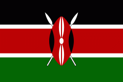
| Flag of Kenya | |
Kenya's earliest inhabitants were hunter-gatherers, like the present-day Hadza people. According to archaeological dating of associated artifacts and skeletal material, Cushitic speakers first settled in Kenya's lowlands between 3,200 and 1,300 BC, a phase known as the Lowland Savanna Pastoral Neolithic. Nilotic-speaking pastoralists (ancestral to Kenya's Nilotic speakers) began migrating from present-day South Sudan into Kenya around 500 BC. Bantu people settled at the coast and the interior between 250 BC and 500 AD. European contact began in 1500 AD with the Portuguese Empire, and effective colonisation of Kenya began in the 19th century during the European exploration of the interior. Modern-day Kenya emerged from a protectorate established by the British Empire in 1895 and the subsequent Kenya Colony, which began in 1920. Numerous disputes between the UK and the colony led to the Mau Mau revolution, which began in 1952, and the declaration of independence in 1963. After independence, Kenya remained a member of the Commonwealth of Nations. The current constitution was adopted in 2010 and replaced the 1963 independence constitution.
Currency / Language
| ISO | Currency | Symbol | Significant figures |
|---|---|---|---|
| KES | Kenyan shilling | Sh | 2 |
| ISO | Language |
|---|---|
| EN | English language |
| SW | Swahili language |


